Live Watch here
Andırın – Town Square
Kahramanmaraş, Turkey 112 km
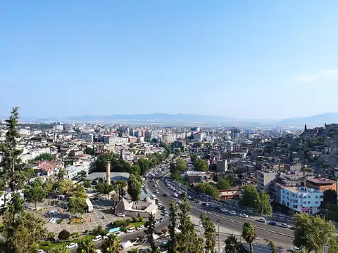
Adana lies in Turkey's Mediterranean Region, at the heart of the fertile Çukurova plain. Home to about 2.1 million people across 15 districts and identified by licence-plate code 01, the province stretches from the foothills of the Taurus Mountains down to the Mediterranean shore around Karataş and Yumurtalık. The historic Taşköprü stone bridge over the Seyhan River, the Sabancı Central Mosque and the famous Adana kebab are among its best-known symbols, while cotton, wider agriculture, industry and trade drive the local economy.
Summers in Adana are long and very hot and winters are usually mild, so temperature, humidity and rain forecasts matter for everyday plans. The route over the Taurus via Pozantı and the Tarsus–Adana–Gaziantep motorway carry heavy traffic, and conditions on the mountain section can change quickly in winter. No cameras are currently listed for the province itself, but nearby live cams, current weather and live data for the surrounding districts are gathered on this page.
Adana (01) is a province of Turkey with 15 districts and about 2,059,893 inhabitants. There is no public official camera in this area right now. Below are the nearest live cams with distances; weather and road risk are calculated for this location.
Sorted by straight-line distance.
Kahramanmaraş, Turkey 112 km

Niğde, Turkey 132 km
Niğde, Turkey 132 km
Niğde, Turkey 132 km
Kahramanmaraş, Turkey 142 km
Kahramanmaraş, Turkey 147 km
Kahramanmaraş, Turkey 155 km
Kahramanmaraş, Turkey 160 km
Each district page has live weather, road risk, neighbouring districts and a satellite map.
Adana lies at 36.986°N 35.325°E, about 30 m above sea level. Nearby: Mersin (65 km), Osmaniye (81 km) and Hatay (98 km). Population: about 2,059,893.
At the latest reading it was 17°C (partly cloudy), with wind at 6 km/h. Over the next 7 days highs average around 26°C and lows around 16°C. The warmest day should be Thu, October 22 (29°C), the coolest night Tue, October 20 (15°C). The 16-day forecast shows rain on 6 days.
Hourly and 16-day forecast: Adana weather.
In the last 12 months 830 earthquakes were recorded in this area; 26 of them were magnitude 3 or above. The largest was a magnitude 5.0 quake near Saimbeyli, Adana on September 21. The nearest active fault line is about 21 km northwest. Earthquake data comes from AFAD and is refreshed every few minutes.
Today the sun rises at 06:47 and sets at 18:00, giving 11 h 14 min of daylight. Around the June solstice daylight lasts 14 h 42 min; around the December solstice, 9 h 37 min. For photos, the evening golden hour starts at about 17:25 today.
There is no camera in Adana yet; the nearest live stream is Andırın – Town Square (112 km).
Live data pages for this place: Adana weather, Adana earthquakes, Adana air quality, Adana sunrise and sunset.
Adana – map and satellite
36.986°N 35.325°E
Map tiles load from the map provider, which receives your IP address.
Live cams near me
Your location is used only on this device to calculate distances; it is never sent to our server.
Your cookie choices
Cookies needed to run the site are always on. We load third-party services for stream autoplay, visit statistics and ads only if you allow them. Details: Cookie policy, Privacy notice.