Live Watch here
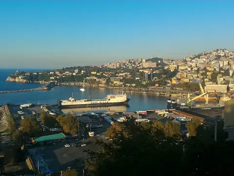
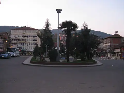
Devrek Town Square, Zonguldak
Devrek, Zonguldak 52 km
Earthquakes · Düzce
1.4 Latest earthquake: · October 16 13:47 · Bolu Central, Bolu · 21 km south
Updated: · Source: AFAD (Afet ve Acil Durum Yönetimi Başkanlığı)
The latest earthquake within 50 km of Yığılca struck 15 h ago (13:47, October 16) near Bolu Central, Bolu: magnitude 1.4, depth 9.0 km, 21 km south of the centre. Within 50 km there have been 1 earthquakes in the last 24 hours, 5 in 7 days, 13 in 30 days and 296 in the past 12 months. The strongest in the past year was a magnitude 3.5 earthquake near Bolu Central, Bolu on December 22. The average depth is 9.0 km; 3 of them reached magnitude 3 or higher. According to the GEM active fault database, the nearest active fault is a right-lateral fault with a normal component about 23 km to the south; there are 5 active fault segments within 50 km.
Updated every 5 minutes from AFAD data. Times are local.
| Magnitude | Time | Place | Depth | Distance |
|---|---|---|---|---|
| 1.4 | 13:47 October 16 | Bolu Central, Bolu | 7.1 km | 21 km south |
| 1.7 | 20:56 October 14 | Bolu Central, Bolu | 7.1 km | 22 km east |
| 1.2 | 14:41 October 13 | Bolu Central, Bolu | 7.0 km | 20 km east |
| 1.3 | 08:12 October 13 | Bolu Central, Bolu | 11.1 km | 35 km southeast |
| 2.0 | 03:22 October 11 | Kaynaşlı, Düzce | 11.8 km | 18 km southwest |
| 1.5 | 16:47 October 6 | Çilimli, Düzce | 7.0 km | 33 km west |
| 1.0 | 04:43 October 6 | Bolu Central, Bolu | 10.0 km | 21 km south |
| 1.1 | 09:39 September 29 | Bolu Central, Bolu | 13.4 km | 19 km southeast |
| 1.3 | 22:34 September 28 | Bolu Central, Bolu | 18.1 km | 19 km southeast |
| 2.2 | 12:18 September 27 | Bolu Central, Bolu | 12.5 km | 21 km south |
| 1.7 | 05:58 September 22 | Bolu Central, Bolu | 8.2 km | 25 km southeast |
| 2.4 | 22:13 September 19 | Bolu Central, Bolu | 8.1 km | 26 km southeast |
| 1.1 | 13:52 September 18 | Ereğli, Zonguldak | 7.0 km | 23 km north |
| 1.2 | 23:21 September 15 | Bolu Central, Bolu | 11.6 km | 22 km southeast |
| 1.3 | 18:17 September 14 | Bolu Central, Bolu | 12.9 km | 21 km south |
| 1.0 | 03:36 September 14 | Bolu Central, Bolu | 7.0 km | 37 km southeast |
| 1.0 | 19:26 September 13 | Bolu Central, Bolu | 7.0 km | 15 km southeast |
| 1.1 | 13:47 September 13 | Bolu Central, Bolu | 10.1 km | 19 km southeast |
| 1.9 | 18:18 September 12 | Bolu Central, Bolu | 11.4 km | 21 km southeast |
| 1.4 | 15:13 September 12 | Bolu Central, Bolu | 11.1 km | 20 km southeast |
| 1.5 | 11:34 September 11 | Bolu Central, Bolu | 11.4 km | 21 km southeast |
| 1.3 | 08:35 September 11 | Bolu Central, Bolu | 8.4 km | 23 km south |
| 2.0 | 06:33 September 10 | Bolu Central, Bolu | 14.0 km | 20 km southeast |
| 1.0 | 12:32 September 8 | Yığılca, Düzce | 5.9 km | 6 km north |
| 1.2 | 08:10 September 8 | Bolu Central, Bolu | 7.0 km | 16 km east |
| 1.5 | 08:47 September 7 | Bolu Central, Bolu | 7.0 km | 20 km southeast |
| 1.9 | 03:34 September 4 | Bolu Central, Bolu | 10.9 km | 20 km southeast |
| 1.5 | 00:17 August 31 | Bolu Central, Bolu | 11.7 km | 22 km southeast |
| 1.3 | 02:49 August 30 | Bolu Central, Bolu | 13.9 km | 20 km southeast |
| 1.2 | 14:10 August 28 | Bolu Central, Bolu | 9.9 km | 22 km southeast |
| 2.1 | 11:08 August 28 | Bolu Central, Bolu | 6.9 km | 22 km east |
| 1.2 | 01:24 August 28 | Bolu Central, Bolu | 7.0 km | 21 km east |
| 1.3 | 07:51 August 26 | Bolu Central, Bolu | 7.0 km | 26 km southeast |
| 1.6 | 07:48 August 25 | Kaynaşlı, Düzce | 9.1 km | 18 km south |
| 1.4 | 07:27 August 25 | Bolu Central, Bolu | 13.2 km | 23 km southeast |
| 1.3 | 23:07 August 24 | Kaynaşlı, Düzce | 13.4 km | 20 km southwest |
| 1.0 | 21:00 August 23 | Bolu Central, Bolu | 14.3 km | 21 km southeast |
| 1.5 | 08:56 August 23 | Yığılca, Düzce | 16.3 km | 17 km south |
| 1.3 | 07:58 August 23 | Bolu Central, Bolu | 10.5 km | 21 km southeast |
| 1.5 | 23:36 August 22 | Bolu Central, Bolu | 15.3 km | 20 km southeast |
By magnitude (last 12 months)
Red circles are earthquakes, dashed lines are active faults.
Yığılca earthquake and fault map
40.960°N 31.445°E
Map tiles load from the map provider, which receives your IP address.
Watch the area on live cams.
Earthquake data is taken automatically from the public AFAD and USGS catalogues; magnitudes and locations may be revised. Follow official agencies for announcements.
Live cams near me
Your location is used only on this device to calculate distances; it is never sent to our server.
Your cookie choices
Cookies needed to run the site are always on. We load third-party services for stream autoplay, visit statistics and ads only if you allow them. Details: Cookie policy, Privacy notice.