
Live Watch here
Saraçhane
Fatih, Istanbul 15 km
Earthquakes · Istanbul
1.6 Latest earthquake: · October 18 11:21 · Silivri, Istanbul · 47 km west
Updated: · Source: AFAD (Afet ve Acil Durum Yönetimi Başkanlığı)
The latest earthquake within 50 km of Küçükçekmece struck 1 days ago (11:21, October 18) near Silivri, Istanbul: magnitude 1.6, depth 8.4 km, 47 km west of the centre. Within 50 km there have been 0 earthquakes in the last 24 hours, 1 in 7 days, 9 in 30 days and 363 in the past 12 months. The strongest in the past year was a magnitude 3.4 earthquake near Silivri, Istanbul on November 13. The average depth is 8.4 km; 3 of them reached magnitude 3 or higher. According to the GEM active fault database, the nearest active fault is a right-lateral strike-slip fault about 13 km to the south; there are 4 active fault segments within 50 km.
Updated every 5 minutes from AFAD data. Times are local.
| Magnitude | Time | Place | Depth | Distance |
|---|---|---|---|---|
| 1.6 | 11:21 October 18 | Silivri, Istanbul | 13.5 km | 47 km west |
| 1.9 | 22:57 October 9 | Büyükçekmece, Istanbul | 7.4 km | 48 km southwest |
| 1.6 | 19:04 October 2 | Beylikdüzü, Istanbul | 14.2 km | 15 km southwest |
| 1.3 | 13:29 September 29 | Adalar, Istanbul | 7.0 km | 37 km southeast |
| 1.6 | 05:58 September 27 | Yalova Central, Yalova | 7.1 km | 50 km southeast |
| 1.1 | 21:55 September 24 | Adalar, Istanbul | 7.0 km | 32 km southeast |
| 1.1 | 21:55 September 24 | Adalar, Istanbul | 7.0 km | 32 km southeast |
| 1.5 | 21:53 September 24 | Adalar, Istanbul | 7.3 km | 30 km southeast |
| 1.9 | 18:10 September 23 | Çınarcık, Yalova | 7.9 km | 43 km southeast |
| 1.4 | 18:49 September 10 | Arnavutköy, Istanbul | 10.4 km | 24 km north |
| 1.1 | 17:55 September 10 | Sarıyer, Istanbul | 7.0 km | 22 km northeast |
| 1.4 | 09:37 September 8 | Çınarcık, Yalova | 5.1 km | 33 km southeast |
| 1.7 | 17:27 September 1 | Büyükçekmece, Istanbul | 7.0 km | 39 km southwest |
| 1.7 | 06:46 August 30 | Çınarcık, Yalova | 7.0 km | 43 km southeast |
| 3.2 | 14:24 August 26 | Armutlu, Yalova | 13.5 km | 35 km south |
| 1.6 | 03:06 August 26 | Beylikdüzü, Istanbul | 7.0 km | 18 km southwest |
| 1.2 | 22:49 August 24 | Adalar, Istanbul | 10.9 km | 37 km southeast |
| 1.8 | 08:11 August 24 | Adalar, Istanbul | 7.0 km | 36 km southeast |
| 1.6 | 00:56 August 24 | Adalar, Istanbul | 7.0 km | 37 km southeast |
| 1.4 | 00:09 August 24 | Adalar, Istanbul | 6.9 km | 34 km southeast |
| 1.2 | 11:04 August 23 | Adalar, Istanbul | 11.9 km | 33 km southeast |
| 1.5 | 01:26 August 22 | Çınarcık, Yalova | 7.0 km | 34 km southeast |
| 1.5 | 13:34 August 21 | Adalar, Istanbul | 7.0 km | 24 km southeast |
| 1.0 | 11:54 August 21 | Adalar, Istanbul | 7.0 km | 37 km southeast |
| 1.7 | 08:14 August 21 | Adalar, Istanbul | 10.7 km | 36 km southeast |
| 1.7 | 08:13 August 21 | Adalar, Istanbul | 12.5 km | 36 km southeast |
| 1.4 | 07:36 August 21 | Adalar, Istanbul | 10.5 km | 38 km southeast |
| 1.2 | 05:45 August 21 | Adalar, Istanbul | 7.0 km | 37 km southeast |
| 1.6 | 05:06 August 21 | Adalar, Istanbul | 7.0 km | 39 km southeast |
| 1.4 | 00:59 August 21 | Adalar, Istanbul | 7.0 km | 35 km southeast |
| 1.4 | 00:56 August 21 | Adalar, Istanbul | 7.0 km | 34 km southeast |
| 2.8 | 00:51 August 21 | Adalar, Istanbul | 13.6 km | 35 km southeast |
| 1.6 | 00:47 August 21 | Adalar, Istanbul | 7.0 km | 35 km southeast |
| 1.7 | 00:47 August 21 | Adalar, Istanbul | 7.0 km | 36 km southeast |
| 1.2 | 22:27 August 20 | Adalar, Istanbul | 9.7 km | 36 km southeast |
| 1.5 | 22:16 August 20 | Adalar, Istanbul | 12.9 km | 35 km southeast |
| 1.3 | 20:15 August 20 | Adalar, Istanbul | 5.9 km | 38 km southeast |
| 1.4 | 19:32 August 20 | Adalar, Istanbul | 7.0 km | 36 km southeast |
| 1.1 | 16:09 August 20 | Adalar, Istanbul | 5.5 km | 42 km southeast |
| 1.2 | 15:29 August 20 | Adalar, Istanbul | 7.0 km | 36 km southeast |
By magnitude (last 12 months)
Red circles are earthquakes, dashed lines are active faults.
Küçükçekmece earthquake and fault map
40.992°N 28.771°E
Map tiles load from the map provider, which receives your IP address.
Watch the area on live cams.
Fatih, Istanbul 15 km

Eyüpsultan, Istanbul 15 km

Fatih, Istanbul 16 km
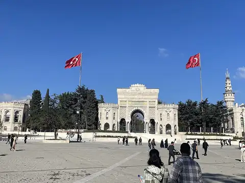
Fatih, Istanbul 16 km
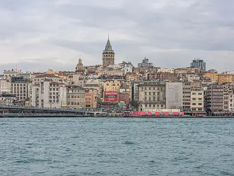
Beyoğlu, Istanbul 16 km

Fatih, Istanbul 17 km
Earthquake data is taken automatically from the public AFAD and USGS catalogues; magnitudes and locations may be revised. Follow official agencies for announcements.
Live cams near me
Your location is used only on this device to calculate distances; it is never sent to our server.
Your cookie choices
Cookies needed to run the site are always on. We load third-party services for stream autoplay, visit statistics and ads only if you allow them. Details: Cookie policy, Privacy notice.